
|
|
Google Maps is a powerful tool that helps millions of people easily navigate the world. Since its launch in 2005, it has become an essential application for travelers, commuters, and explorers. One of its standout features is the satellite view, which provides detailed, real-world imagery of locations across the globe. This feature offers a bird’s-eye perspective, making it easier to understand the terrain, find landmarks, and even explore remote areas. In this article, we will discuss how to see satellite views in Google Maps in detail.
Table of Content How to See Satellite View in Google Maps on DesktopStep 1: Open Google MapsVisit Google Maps on your desktop or laptop device in any modern browser. 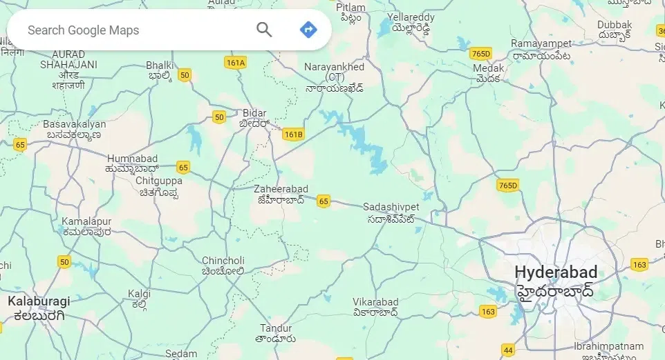 Google Maps opened in browser Step 2: Move the cursor on LayersMove your cursor on Layers which is at the bottom leftmost corner of the website. A panel of options is displayed. 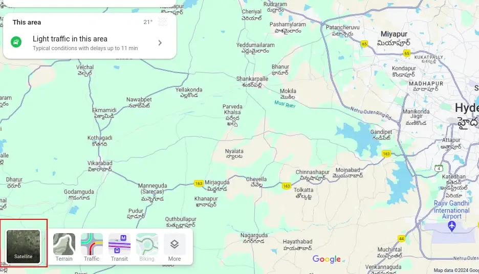 Move the cursor on Layers Step 3: Click MoreClick on “More” in the panel opened from the “Layers“. 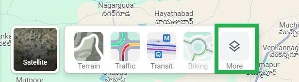 Click ‘More’ Step 4: Click on SatelliteUnder map type, click on “Satellite” to see the map in Satellite view. 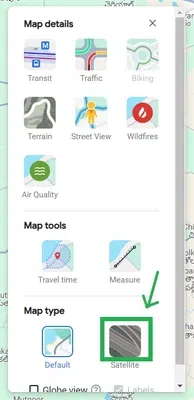 Click ‘Satellite’ Step 5: Click on the Close IconClick on the close icon “X” at the panel to close the layers panel. 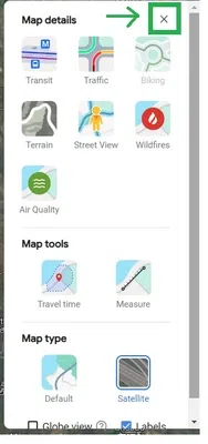 Click on the ‘X’ icon to close the panel Step 6: Google Maps reloadedNow Google Maps is reloaded automatically to satellite mode.  Satellite view enabled in Google Maps You have successfully enabled Satellite View in Google Maps on Desktop. How to Start Google Maps in Satellite View on an iPhone or iPadGoogle Maps can be made to open in satellite view always automatically once we set it. But this can be done directly on Android devices. In iOS devices, there is no specific setting available in the Google Maps app. But once we set the satellite view, iOS automatically remembers it as a setting and opens the app in satellite view always. Let us discuss how to start Google Maps in satellite view on an iPhone or iPad. Step 1: Launch the Google Maps and Tap on the layers iconLaunch the Google Maps app on your iOS device. Tap on the layers icon at the top right-most side of the app. 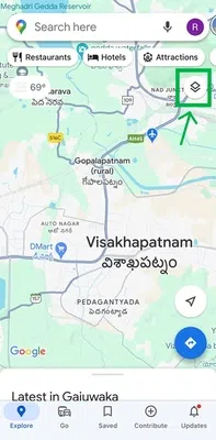 Tap on the layers icon Step 2: Tap on SatelliteA panel opens from the bottom of the app. Tap on “Satellite” in the bottom panel.  Tap on ‘Satellite’ in the bottom panel Step 3: Tap on the closeTap on the close icon ‘X’ in the panel to close the panel. 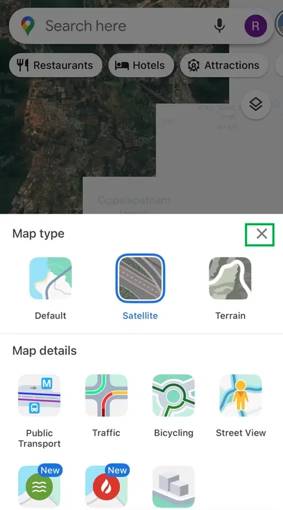 Tap on the ‘X’ icon to close the panel Step 4: Satellite view enabledYou can see that the satellite view is loaded automatically in the app now. 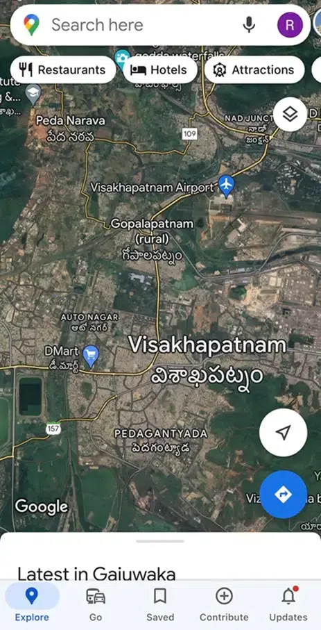 Satellite view is enabled in the Google Maps app You have successfully enabled Google Maps in Satellite View on an iPhone or iPad. How to Enable Satellite View by Default on AndroidStep 1: Open the Google Maps appOpen the Google Maps app on your Android device.  Tap on the Google Maps app icon to open Step 2: Tap on the profile iconTap on the profile icon which is at the top rightmost corner of the app. 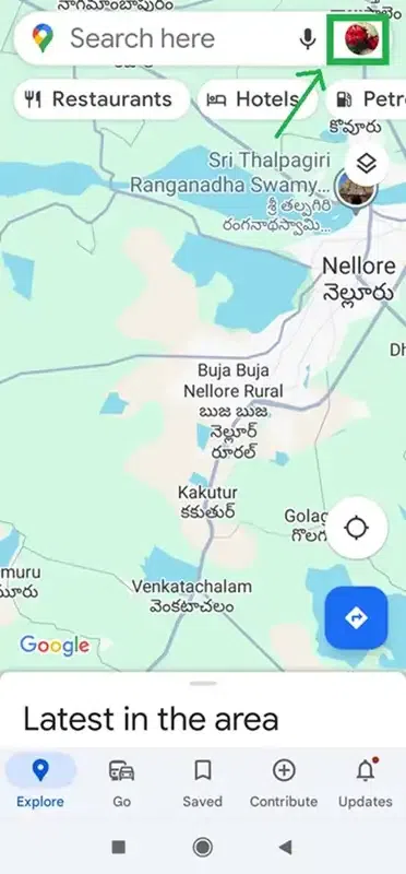 Tap on the profile icon at the top rightmost corner Step 3: Tap on SettingsA panel opens up. Tap on “Settings” in the panel. 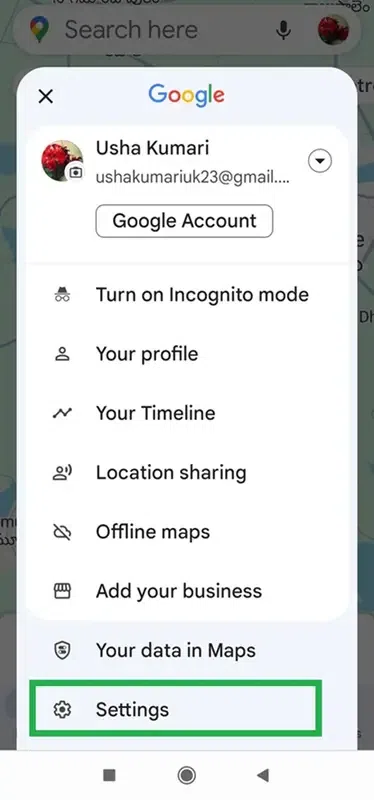 Tap on ‘Settings’ in the panel opened Step 4: Turn on Start maps in the satellite viewAnother sub-panel opens up. Turn on the toggle button “Start maps in satellite view” to enable your Android device to always open in satellite view. 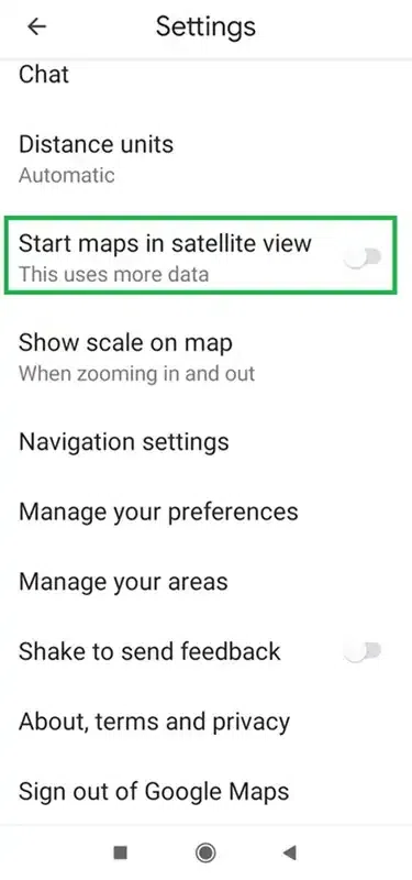 Tap on the toggle button to turn on After turning on the toggle button, the toggle button is now on in blue color. 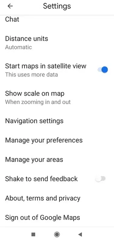 The Toggle button is now ON Step 5: Tap on the back button iconTap on the back button icon at the top rightmost corner of the app to go back to the Google Maps app’s home screen. 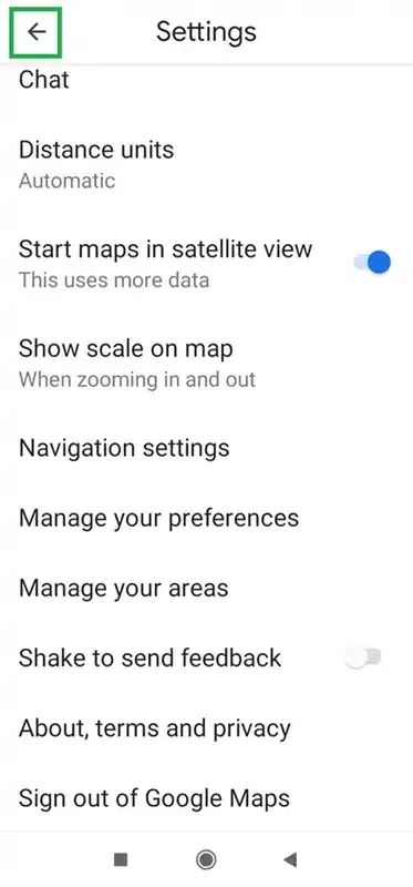 Tap on the back button Google Maps is now in satellite mode. 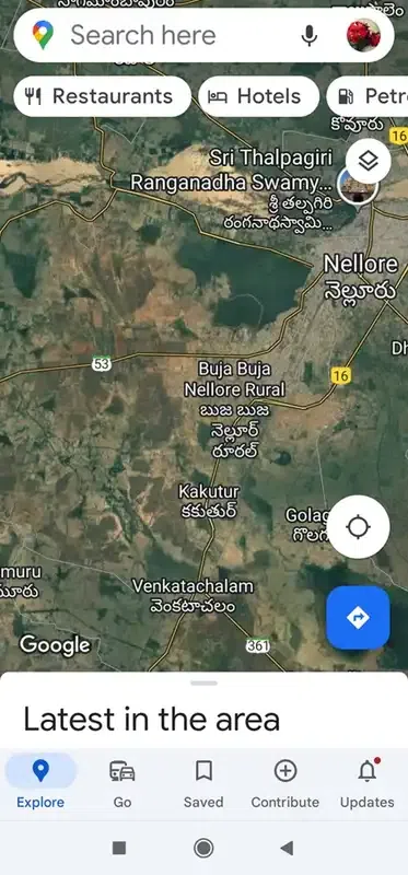 Google Maps is now in satellite mode You have successfully Enabled Satellite View by Default on Android. Benefits of Using Satellite View
ConclusionIn this article, we have discussed the satellite view and how to enable it. Also, we have discussed the steps to see satellite views on the desktop, Android, and iOS versions of Google Maps that not only helps in understanding the terrain and finding landmarks but also provides a unique perspective on our world. With the power of satellite imagery, make your exploration more engaging and informative. How to Start Google Maps in Satellite View – FAQsHow to on Satellite Mode in Google Maps?
Can I set Google Maps to always start in satellite view?
Is satellite view available on the Google Maps mobile app?
How often is Google Maps satellite view updated?
Can I use satellite view on Google Maps without an internet connection?
What are the benefits of using satellite view on Google Maps?
|
Reffered: https://www.geeksforgeeks.org
| Geeks Premier League |
Type: | Geek |
Category: | Coding |
Sub Category: | Tutorial |
Uploaded by: | Admin |
Views: | 13 |